Geolocate

Corballis topographic map

Click on the map to display elevation.

About this map

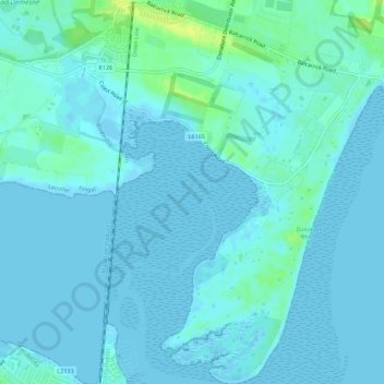
Name: Corballis topographic map, elevation, terrain.

Location: Corballis, Donabate DED 1986, Fingal, County Dublin, Leinster, Ireland (53.45249 -6.15282 53.48535 -6.11906)

Average elevation: 3 m

Minimum elevation: -2 m

Maximum elevation: 17 m

Other topographic maps

Click on a map to view its topography, its elevation and its terrain.

Castleknock

Ireland > County Dublin

As the word Castle did not come into use in Ireland until Norman times we know that Castleknock is a name of comparatively recent origin. Documents from the 12th and 13th centuries refer to the place as Castrum Cnoc, simply Cnoc and also Chastel-cnoc or Castel-Cnoc. So it seems that the name Castleknock is…

Average elevation: 55 m

Sutton

Ireland > County Dublin

Average elevation: 8 m

14

Ireland > County Dublin > Blackrock

Average elevation: 48 m

Palmerstown

Ireland > County Dublin > Palmerstown

Average elevation: 51 m

Kilternan

Ireland > County Dublin

Average elevation: 173 m

Lucan

Ireland > County Dublin > Lucan

Average elevation: 59 m

Ballymount

Ireland > County Dublin > Clondalkin

Average elevation: 68 m

Ballyboden

Ireland > County Dublin

Average elevation: 83 m

Clonsilla

Ireland > County Dublin

Average elevation: 59 m

Gear up for your next adventure:

🍱Food Containers - Reusable containers for outdoor meals
📢Survival Whistles - Essential safety gear for signaling for help in mountain fog
🎒Hiking Child Carriers - Explore the outdoors with the whole family safely
Lightweight Solo Tents - Backpacking tents designed for wild camping in the UK highlands
🧤Hiking Gloves - Warm and durable gloves for cold-weather walks

As an Amazon Associate, this site earns from qualifying purchases at no extra cost to you.