
Pisang topographic map
Interactive map
Click on the map to display elevation.
About this map
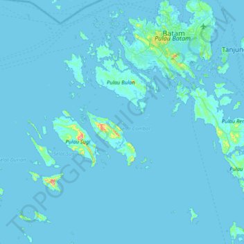
Name: Pisang topographic map, elevation, terrain.
Location: Pisang, Kepulauan Riau, Indonésie (0.54944 103.58222 1.18944 104.22222)
Average elevation: 5 m
Minimum elevation: -2 m
Maximum elevation: 265 m
Other topographic maps
Click on a map to view its topography, its elevation and its terrain.
Tanjung Pinggir
Indonésie > Îles Riau > Batam > Tanjung Pinggir
Tanjung Pinggir, Batam, Iles Riau, 20444, Indonésie
Average elevation: 6 m