
Ober Gabelhorn topographic map
Interactive map
Click on the map to display elevation.
About this map
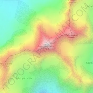
Name: Ober Gabelhorn topographic map, elevation, terrain.
Location: Ober Gabelhorn, Zermatt, Visp, Valais/Wallis, 3920, Zwitserland (46.03799 7.66755 46.03809 7.66765)
Average elevation: 3,320 m
Minimum elevation: 2,744 m
Maximum elevation: 4,056 m
Other topographic maps
Click on a map to view its topography, its elevation and its terrain.
Dufourspitze (Monte Rosa)
Zwitserland > Valais/Wallis > Zermatt
Dufourspitze (Monte Rosa), Zermatt, Visp, Valais/Wallis, 3920, Zwitserland
Average elevation: 4,033 m
Walliser Alpen
Zwitserland > Valais/Wallis > Zermatt
Walliser Alpen, Zermatt, Visp, Valais/Wallis, 3920, Zwitserland
Average elevation: 3,842 m