Geolocate

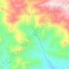
Iraj topographic map

Click on the map to display elevation.

About this map

Name: Iraj topographic map, elevation, terrain.

Location: Iraj, دهستان روئین, بخش مرکزی شهرستان اسفراین, Esfarayen County, North Khorasan Province, Iran (37.11848 57.39923 37.13230 57.40969)

Average elevation: 1,229 m

Minimum elevation: 1,147 m

Maximum elevation: 1,410 m

Other topographic maps

Click on a map to view its topography, its elevation and its terrain.
Gear up for your next adventure:

📐Altimeters & Barometers - Tools for measuring altitude and air pressure
🔋Solar Power Banks - Keep your GPS and phone charged during multi-day expeditions
🦶Anti-Blister Balms - Protect your feet before long topographic expeditions
📱Phone Mounts for Hiking - Secure mounts to carry your phone on trails
📚UK Hiking Guidebooks - Detailed route descriptions for the Lake District, Peaks, and Highlands

As an Amazon Associate, this site earns from qualifying purchases at no extra cost to you.