Geolocate

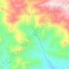
Iraj topographic map

Click on the map to display elevation.

About this map

Name: Iraj topographic map, elevation, terrain.

Location: Iraj, دهستان روئین, بخش مرکزی شهرستان اسفراین, Esfarayen County, North Khorasan Province, Iran (37.11848 57.39923 37.13230 57.40969)

Average elevation: 1,229 m

Minimum elevation: 1,147 m

Maximum elevation: 1,410 m

Other topographic maps

Click on a map to view its topography, its elevation and its terrain.
Gear up for your next adventure:

🧰Survival Kits - Emergency tools for remote environments
⛺Camping Shelters - Emergency and lightweight shelters for outdoor use
🧴Sport Sunscreen Sticks - High-protection sunblock that won't run into your eyes on the trail
📦Compression Sacks - Reduce backpack volume efficiently
🧣Neck Gaiters - Protects against wind and sun on exposed ridges and peaks

As an Amazon Associate, this site earns from qualifying purchases at no extra cost to you.