
Reith topographic map
Interactive map
Click on the map to display elevation.
About this map
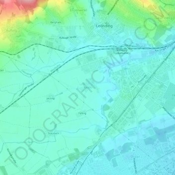
Name: Reith topographic map, elevation, terrain.
Location: Reith, Leonding, Bezirk Linz-Land, 4060, Österreich (48.24518 14.22297 48.28518 14.26297)
Average elevation: 289 m
Minimum elevation: 264 m
Maximum elevation: 405 m