Geolocate

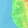
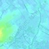
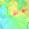
Éperlecques topographic map

Click on the map to display elevation.

About this map

Name: Éperlecques topographic map, elevation, terrain.

Location: Éperlecques, Saint-Omer, Pas-de-Calais, Hauts-de-France, Metropolitan France, 62910, France (50.77660 2.10363 50.84530 2.21300)

Average elevation: 35 m

Minimum elevation: 0 m

Maximum elevation: 107 m

Other topographic maps

Click on a map to view its topography, its elevation and its terrain.

Panehem

France > Hauts-de-France > Pas-de-Calais > Samer

Average elevation: 70 m

Le Petit Vimy

France > Hauts-de-France > Pas-de-Calais > Vimy

Average elevation: 93 m

Noyelles

France > Hauts-de-France > Pas-de-Calais > Bours

Average elevation: 125 m

Gear up for your next adventure:

🧼Camping Hygiene Kits - Compact hygiene essentials for outdoor stays
🔦Outdoor Torches - Reliable torches for night navigation
🧣Neck Gaiters - Versatile protection against wind and cold
🖼️Topographic Map Art - Decorative 3D-effect posters of famous UK peaks and regions
🛌Sleeping Bags - Warm and packable sleeping bags for outdoor nights

As an Amazon Associate, this site earns from qualifying purchases at no extra cost to you.