Geolocate

Straiton topographic map

Click on the map to display elevation.

About this map
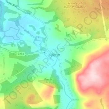
Name: Straiton topographic map, elevation, terrain.

Location: Straiton, South Ayrshire, Scotland, KA19 7NF, United Kingdom (55.29145 -4.57206 55.33145 -4.53206)

Average elevation: 186 m

Minimum elevation: 94 m

Maximum elevation: 350 m

South Ayrshire trails, hiking, mountain biking, running and outdoor activities

Other topographic maps

Click on a map to view its topography, its elevation and its terrain.
Gear up for your next adventure:

🛌Sleeping Mats - Insulated mats for comfortable outdoor sleeping
🧤Waterproof Overmitts - Extreme weather protection for hikers and mountaineers
🎒Hiking Backpacks - Comfortable backpacks for day hikes and multi-day treks
🥾Women's Waterproof Hiking Boots - High-performance trekking boots designed for all-weather comfort
🗺️Scratch-off Peak Maps - Track your progress climbing Munros or Wainwrights

As an Amazon Associate, this site earns from qualifying purchases at no extra cost to you.