Geolocate

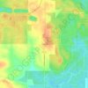
Merom topographic map

Click on the map to display elevation.

About this map

Name: Merom topographic map, elevation, terrain.

Location: Merom, Sullivan County, Indiana, United States (39.04965 -87.57245 39.06258 -87.56257)

Average elevation: 149 m

Minimum elevation: 126 m

Maximum elevation: 184 m

Other topographic maps

Click on a map to view its topography, its elevation and its terrain.
Bucktown

United States > Indiana > Sullivan County

Average elevation: 167 m

Fairbanks

United States > Indiana > Sullivan County

Average elevation: 164 m

Gear up for your next adventure:

🗺️Topographic Maps - Detailed maps showing elevation and terrain features
🔋Solar Chargers - Eco-friendly charging solutions for outdoor use
📍Handheld GPS Navigators - Reliable satellite navigation for hiking and off-road exploration
🧭Professional Hiking Compasses - High-precision liquid-filled compasses for map reading and orientation
💧Hydration Reservoirs - Convenient water bladders for hands-free drinking on the move

As an Amazon Associate, this site earns from qualifying purchases at no extra cost to you.