Geolocate

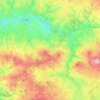
Chereix topographic map

Click on the map to display elevation.

About this map

Name: Chereix topographic map, elevation, terrain.

Location: Chereix, Châtelus-Malvaleix, Guéret, Creuse, Nouvelle-Aquitaine, France métropolitaine, 23270, France (46.29205 1.99604 46.33205 2.03604)

Average elevation: 378 m

Minimum elevation: 296 m

Maximum elevation: 511 m

Other topographic maps

Click on a map to view its topography, its elevation and its terrain.
23270

France > Nouvelle-Aquitaine > Creuse > Châtelus-Malvaleix

Average elevation: 402 m

Gear up for your next adventure:

🎒Backpack Rain Covers - Universal waterproof covers to protect your gear from downpours
🧴Tick Removal Tools - Small, essential health tool for UK woodland and moorland
🚲Bikepacking Frame Bags - Storage for tools and navigation gear on long off-road rides
🎿Telescopic Trekking Poles - Reduces knee strain on steep topographic descents
🥾Hiking Boots - Waterproof and durable boots for long-distance hiking in the UK

As an Amazon Associate, this site earns from qualifying purchases at no extra cost to you.