
Thank you for supporting this site ❤️
Make a donation
Make a donation
Gear up for your next adventure:
As an Amazon Associate, this site earns from qualifying purchases at no extra cost to you.
Binnaguri topographic map
Click on the map to display elevation.
Thank you for supporting this site ❤️
Make a donation
Make a donation
Gear up for your next adventure:
As an Amazon Associate, this site earns from qualifying purchases at no extra cost to you.
About this map
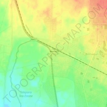
Name: Binnaguri topographic map, elevation, terrain.
Location: Binnaguri, Dhupguri, Jalpaiguri District, West Bengal, India (26.72518 89.03313 26.76518 89.07313)
Average elevation: 129 m
Minimum elevation: 102 m
Maximum elevation: 154 m
Thank you for supporting this site ❤️
Make a donation
Make a donation
Gear up for your next adventure:
As an Amazon Associate, this site earns from qualifying purchases at no extra cost to you.