
Smooth Rock Falls topographic map
Interactive map
Click on the map to display elevation.
About this map
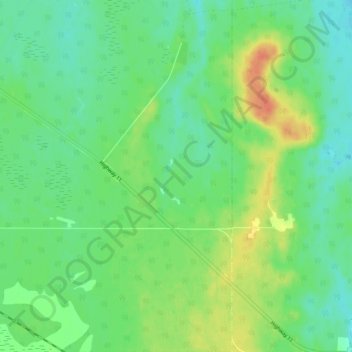
Name: Smooth Rock Falls topographic map, elevation, terrain.
Location: Smooth Rock Falls, Cochrane District, Ontario, Canada (49.18907 -81.50000 49.25000 -81.47026)
Average elevation: 262 m
Minimum elevation: 247 m
Maximum elevation: 287 m
Other topographic maps
Click on a map to view its topography, its elevation and its terrain.
Smooth Rock Falls
Canada > Ontario > Smooth Rock Falls
Smooth Rock Falls, Cochrane District, Ontario, P0L 2B0, Canada
Average elevation: 248 m