
Diedorf topographic map
Interactive map
Click on the map to display elevation.
About this map
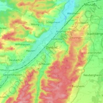
Name: Diedorf topographic map, elevation, terrain.
Location: Diedorf, Augsburg (district), Bavaria, 86420, Germany (48.30416 10.71166 48.39672 10.80609)
Average elevation: 506 m
Minimum elevation: 455 m
Maximum elevation: 576 m
Other topographic maps
Click on a map to view its topography, its elevation and its terrain.