Geolocate

Felton topographic map

Click on the map to display elevation.

About this map

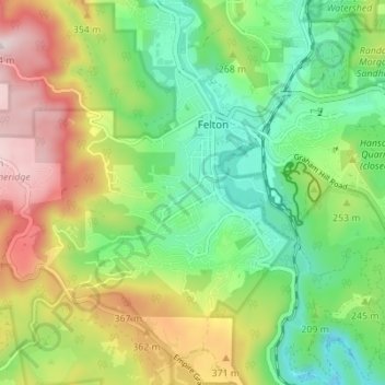
Name: Felton topographic map, elevation, terrain.

Location: Felton, Santa Cruz County, California, United States (37.02352 -122.10617 37.05955 -122.03730)

Average elevation: 230 m

Minimum elevation: 26 m

Maximum elevation: 558 m

Other topographic maps

Click on a map to view its topography, its elevation and its terrain.

Gear up for your next adventure:

👖Convertible Hiking Trousers - Versatile zip-off pants for changing mountain weather conditions
🔥Reusable Hand Warmers - Maintain dexterity in your fingers for precise map handling
🧥Waterproof Hiking Jackets - Rain protection for walking in all weather conditions
📷Outdoor Action Cameras - Cameras designed for hiking and adventure
🛑Emergency Bivvy Bags - Heat-reflective survival bags for unexpected nights out

As an Amazon Associate, this site earns from qualifying purchases at no extra cost to you.