
Sliffert topographic map
Interactive map
Click on the map to display elevation.
About this map
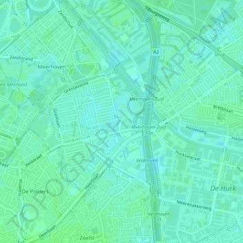
Name: Sliffert topographic map, elevation, terrain.
Location: Sliffert, Eindhoven, Noord-Brabant, Nederland, 5657, Nederland (51.42787 5.41166 51.44787 5.43166)
Average elevation: 21 m
Minimum elevation: 17 m
Maximum elevation: 24 m
Other topographic maps
Click on a map to view its topography, its elevation and its terrain.
Riel
Nederland > Noord-Brabant > Eindhoven
Riel, Stratum, Eindhoven, Noord-Brabant, Nederland, 5647 LA, Nederland
Average elevation: 21 m
Eindhoven
Nederland > Noord-Brabant > Eindhoven
Eindhoven, Noord-Brabant, Nederland, 5611EB, Nederland
Average elevation: 21 m
Sliffert
Nederland > Noord-Brabant > Eindhoven
Sliffert, Grasrijk, Strijp, Eindhoven, Noord-Brabant, Nederland, 5657 AR, Nederland
Average elevation: 21 m
Beatrixkanaal
Nederland > Noord-Brabant > Eindhoven
Beatrixkanaal, Eindhoven, Noord-Brabant, Nederland, 5652BG, Nederland
Average elevation: 20 m