Isfahan topographic map
Click on the map to display elevation.
Isfahan
Situated at 1,590 metres (5,217 ft) above sea level on the eastern side of the Zagros Mountains, Isfahan has a cold desert climate (Köppen BWk). No geological obstacles exist within 90 kilometres (56 miles) north of the city, allowing cool winds to blow from this direction. Despite its altitude, Isfahan remains hot during the summer, with maxima typically around 35 °C (95 °F). However, with low humidity and moderate temperatures at night, the climate is quite pleasant. During the winter, days are cool while nights can be very cold. Snow falls an average of 6.7 days each winter. However, generally Isfahan's climate is extremely dry. Its annual precipitation of 125 millimetres (4.9 in) is only about half that of Tehran or Mashhad and only a quarter that of more exposed Kermanshah.
About this map
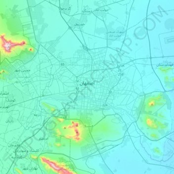
Name: Isfahan topographic map, elevation, terrain.
Average elevation: 1,607 m
Minimum elevation: 1,535 m
Maximum elevation: 2,469 m
Other topographic maps
Click on a map to view its topography, its elevation and its terrain.