Geolocate

Damascus topographic map

Click on the map to display elevation.

About this map

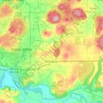
Name: Damascus topographic map, elevation, terrain.

Location: Damascus, Clackamas County, Oregon, 97089, United States (45.38259 -122.50770 45.46158 -122.39816)

Average elevation: 160 m

Minimum elevation: 28 m

Maximum elevation: 343 m

Gear up for your next adventure:

🔦Outdoor Torches - Reliable torches for night navigation
💧Hydration Reservoirs - Convenient water bladders for hands-free drinking on the move
🥾Women's Waterproof Hiking Boots - High-performance trekking boots designed for all-weather comfort
🧤Hiking Gloves - Warm and durable gloves for cold-weather walks
🖼️Topographic Map Art - Decorative 3D-effect posters of famous UK peaks and regions

As an Amazon Associate, this site earns from qualifying purchases at no extra cost to you.