
Lac-Masketsi topographic map
Interactive map
Click on the map to display elevation.
About this map
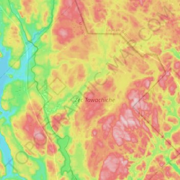
Name: Lac-Masketsi topographic map, elevation, terrain.
Location: Lac-Masketsi, Mékinac, Mauricie, Québec, Canada (46.97059 -72.63272 47.18358 -72.37895)
Average elevation: 317 m
Minimum elevation: 157 m
Maximum elevation: 492 m
Other topographic maps
Click on a map to view its topography, its elevation and its terrain.
Zec Tawachiche
Canada > Québec > Lac-Masketsi
Zec Tawachiche, Lac-Masketsi, Mékinac, Mauricie, Québec, Canada
Average elevation: 310 m