Geolocate

Canlapwas topographic map

Click on the map to display elevation.

About this map

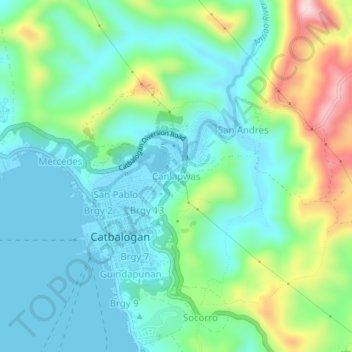
Name: Canlapwas topographic map, elevation, terrain.

Location: Canlapwas, Catbalogan, Samar, Eastern Visayas, Philippines (11.76221 124.86946 11.80221 124.90946)

Average elevation: 81 m

Minimum elevation: 0 m

Maximum elevation: 302 m

Gear up for your next adventure:

💧Hydration Reservoirs - Convenient water bladders for hands-free drinking on the move
🎒Hiking Backpacks - Comfortable backpacks for day hikes and multi-day treks
👟Men's Trail Running Shoes - Lightweight grip for fast movement over topographic contours
🔭Compact Hiking Binoculars - Lightweight optics for scouting terrain and spotting wildlife
🗺️Ordnance Survey Maps - Official UK maps for walking and outdoor activities

As an Amazon Associate, this site earns from qualifying purchases at no extra cost to you.