
Messex topographic map
Interactive map
Click on the map to display elevation.
About this map
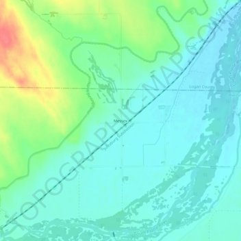
Name: Messex topographic map, elevation, terrain.
Location: Messex, Washington County, Colorado, États-Unis (40.40943 -103.45661 40.44943 -103.41661)
Average elevation: 1,254 m
Minimum elevation: 1,238 m
Maximum elevation: 1,301 m