
Nederhasselt topographic map
Interactive map
Click on the map to display elevation.
About this map
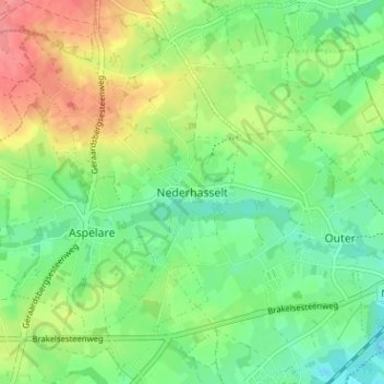
Name: Nederhasselt topographic map, elevation, terrain.
Location: Nederhasselt, Aalst, Oost-Vlaanderen, Vlaanderen, 9406, België (50.82636 3.95502 50.86636 3.99502)
Average elevation: 35 m
Minimum elevation: 7 m
Maximum elevation: 79 m