
Langen topographic map
Interactive map
Click on the map to display elevation.
About this map
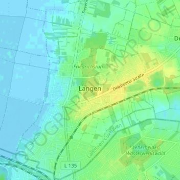
Name: Langen topographic map, elevation, terrain.
Location: Langen, Geestland, Landkreis Cuxhaven, Baja Sajonia, Alemania (53.59310 8.57755 53.62956 8.62559)
Average elevation: 7 m
Minimum elevation: -3 m
Maximum elevation: 20 m