
Thank you for supporting this site ❤️
Make a donation
Make a donation
Gear up for your next adventure:
As an Amazon Associate, this site earns from qualifying purchases at no extra cost to you.
Nogoonnuur topographic map
Click on the map to display elevation.
Thank you for supporting this site ❤️
Make a donation
Make a donation
Gear up for your next adventure:
As an Amazon Associate, this site earns from qualifying purchases at no extra cost to you.
About this map
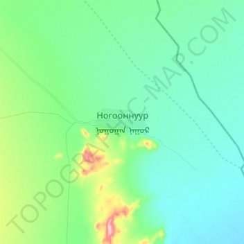
Name: Nogoonnuur topographic map, elevation, terrain.
Location: Nogoonnuur, Bayan-Ölgii, Mongolia (49.57609 90.20266 49.65609 90.28266)
Average elevation: 1,496 m
Minimum elevation: 1,457 m
Maximum elevation: 1,644 m
Thank you for supporting this site ❤️
Make a donation
Make a donation
Gear up for your next adventure:
As an Amazon Associate, this site earns from qualifying purchases at no extra cost to you.