
เถิน topographic map
Interactive map
Click on the map to display elevation.
About this map
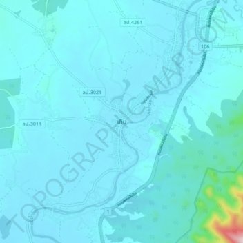
Name: เถิน topographic map, elevation, terrain.
Location: เถิน, เถินบุรี, อำเภอเถิน, Lampang, Thailand (17.56525 99.16947 17.64525 99.24947)
Average elevation: 187 m
Minimum elevation: 157 m
Maximum elevation: 622 m
Other topographic maps
Click on a map to view its topography, its elevation and its terrain.