
Enxalé topographic map
Interactive map
Click on the map to display elevation.
About this map
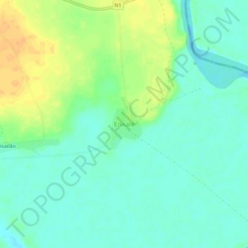
Name: Enxalé topographic map, elevation, terrain.
Location: Enxalé, Oio Region, Província Norte, Guinea-Bissau (11.96934 -14.98845 12.00934 -14.94845)
Average elevation: 12 m
Minimum elevation: -1 m
Maximum elevation: 33 m
Other topographic maps
Click on a map to view its topography, its elevation and its terrain.
Quidè
Guinea-Bissau > Oio Region > Sector de Nhacra
Quidè, Sector de Nhacra, Oio Region, North, Guinea-Bissau
Average elevation: 18 m