
Bahía Ballena topographic map
Interactive map
Click on the map to display elevation.
About this map
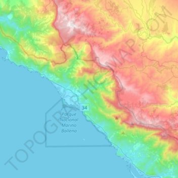
Name: Bahía Ballena topographic map, elevation, terrain.
Average elevation: 384 m
Minimum elevation: -2 m
Maximum elevation: 1,258 m
Other topographic maps
Click on a map to view its topography, its elevation and its terrain.
Uvita
Costa Rica > Cantón Osa > Bahía Ballena > Uvita
Uvita, Bahía Ballena, Cantón Osa, Provincia Puntarenas, 60504, Costa Rica
Average elevation: 82 m
Ojochal
Costa Rica > Cantón Osa > Puerto Cortés
Ojochal, Puerto Cortés, Cantón Osa, Puntarenas Province, 60501, Costa Rica
Average elevation: 88 m