Geolocate

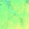
Ripley topographic map

Click on the map to display elevation.

About this map

Name: Ripley topographic map, elevation, terrain.

Location: Ripley, Union Township, Brown County, Ohio, United States (38.71091 -83.85386 38.76066 -83.80851)

Average elevation: 206 m

Minimum elevation: 147 m

Maximum elevation: 279 m

Other topographic maps

Click on a map to view its topography, its elevation and its terrain.

Feesburg

United States > Ohio > Brown County

Average elevation: 280 m

Chasetown

United States > Ohio > Brown County

Average elevation: 288 m

Yankeetown

United States > Ohio > Brown County

Average elevation: 284 m

Gear up for your next adventure:

📱Rugged Phone Cases - Heavy-duty protection for smartphones used as secondary GPS tools
🥤Hiking Water Bottles - Reusable bottles for hydration on the trail
🎒Hiking Daypacks (20L) - Compact backpacks for day trips and technical mountain ascents
🧤Waterproof Overmitts - Extreme weather protection for hikers and mountaineers
👟Waterproof Leg Gaiters - Keep mud and water out of your boots in boggy terrain

As an Amazon Associate, this site earns from qualifying purchases at no extra cost to you.