
Erikvalla topographic map
Interactive map
Click on the map to display elevation.
About this map
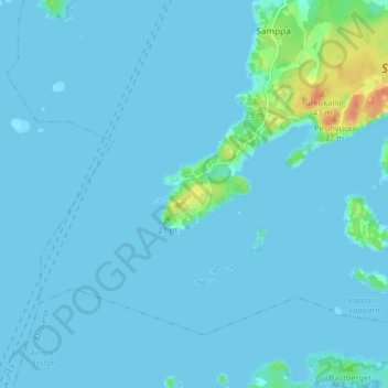
Name: Erikvalla topographic map, elevation, terrain.
Average elevation: 3 m
Minimum elevation: -2 m
Maximum elevation: 40 m
Other topographic maps
Click on a map to view its topography, its elevation and its terrain.
III
Finland > Southwest Finland > Turku
III, City Centre, Turku, Turku sub-region, Southwest Finland, South-Western Finland, Mainland Finland, 20800, Finland
Average elevation: 19 m
IX
Finland > Southwest Finland > Turku
IX, City Centre, Turku, Turku sub-region, Southwest Finland, South-Western Finland, Mainland Finland, Finland
Average elevation: 10 m