
Alaili Dadda` topographic map
Interactive map
Click on the map to display elevation.
Alaili Dadda`
Alaili Dadda` (Arabic: علايلي دادا) is a town in northern Djibouti. It is situated about 68 kilometers north of Obock, at an elevation of 1,263 feet from sea level. The town sprawls on a wide basin surrounded by granitic mountains on all sides. It is located in the Alaili Dadda district of the Obock region. N16 road is located on. to the nearest settlements, Khor Angar, Dadda'to and Obock. The capital city Djibouti to quite far, but close to the city outside the two major Dadda'to. Is the capital of Obock region. Khor Angar the second largest city in the region. Dadda Alaile the 4th largest in the region or 5th.
About this map
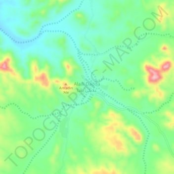
Name: Alaili Dadda` topographic map, elevation, terrain.
Location: Alaili Dadda`, Alaili Dadda District, Obock, Djibouti (12.38785 42.88100 12.42785 42.92100)
Average elevation: 400 m
Minimum elevation: 337 m
Maximum elevation: 531 m