Geolocate

Paris topographic map

Click on the map to display elevation.

About this map

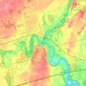
Name: Paris topographic map, elevation, terrain.

Location: Paris, Brant County, Ontario, N3L 2M3, Canada (43.15323 -80.42428 43.23323 -80.34428)

Average elevation: 258 m

Minimum elevation: 208 m

Maximum elevation: 294 m

Gear up for your next adventure:

🧭GPS Trackers - Tracking devices for safety and navigation
🔋Solar Chargers - Eco-friendly charging solutions for outdoor use
🧴Sport Sunscreen Sticks - High-protection sunblock that won't run into your eyes on the trail
🧤Thermal Touchscreen Gloves - Stay warm while operating your GPS or smartphone camera
🍱Food Containers - Reusable containers for outdoor meals

As an Amazon Associate, this site earns from qualifying purchases at no extra cost to you.