
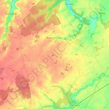
Prunay-Cassereau topographic map
Interactive map
Click on the map to display elevation.
About this map
Name: Prunay-Cassereau topographic map, elevation, terrain.
Average elevation: 134 m
Minimum elevation: 92 m
Maximum elevation: 158 m
Other topographic maps
Click on a map to view its topography, its elevation and its terrain.
La Cousinerie
France > Centre-Val de Loire > Loir-et-Cher > Prunay-Cassereau
La Cousinerie, Prunay-Cassereau, Vendôme, Loir-et-Cher, Centre-Val de Loire, France métropolitaine, 41310, France
Average elevation: 134 m