Geolocate

Gropper topographic map

Click on the map to display elevation.

About this map

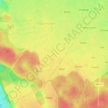
Name: Gropper topographic map, elevation, terrain.

Location: Gropper, Memmingen, Bavaria, Germany (47.93553 10.13641 47.93705 10.13873)

Average elevation: 640 m

Minimum elevation: 600 m

Maximum elevation: 661 m

Gear up for your next adventure:

🌄Outdoor Binoculars - Compact binoculars for landscape observation
🧭Orienteering Compasses - Accurate compasses for map-based navigation
🔦Outdoor Torches - Reliable torches for night navigation
🛰️Outdoor GPS Navigation - Navigation devices for remote and off-grid areas
📐Altimeters & Barometers - Tools for measuring altitude and air pressure

As an Amazon Associate, this site earns from qualifying purchases at no extra cost to you.