Geolocate

Winburn topographic map

Click on the map to display elevation.

About this map

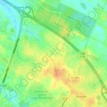
Name: Winburn topographic map, elevation, terrain.

Location: Winburn, Lexington, Fayette County, Kentucky, United States (38.08298 -84.48412 38.09555 -84.46667)

Average elevation: 292 m

Minimum elevation: 274 m

Maximum elevation: 311 m

Other topographic maps

Click on a map to view its topography, its elevation and its terrain.

Radcliffe

United States > Kentucky > Fayette County > Lexington

Average elevation: 298 m

Monticello

United States > Kentucky > Fayette County > Lexington

Average elevation: 302 m

Donerail

United States > Kentucky > Fayette County > Lexington

Average elevation: 270 m

Greendale

United States > Kentucky > Fayette County > Lexington

Average elevation: 284 m

Shadeland

United States > Kentucky > Fayette County > Lexington

Average elevation: 309 m

Fenwick

United States > Kentucky > Fayette County > Lexington

Average elevation: 293 m

Paynes

United States > Kentucky > Fayette County > Lexington

Average elevation: 289 m

Gear up for your next adventure:

📦Compression Sacks - Reduce backpack volume efficiently
🕶️Polarized Sunglasses - Reduces glare from snow and water when reading terrain
🐕Dog Hiking Gear - Equipment for hiking safely with dogs
👖Packable Overtrousers - Quick-deploy rain protection for legs in sudden storms
🛌Sleeping Mats - Insulated mats for comfortable outdoor sleeping

As an Amazon Associate, this site earns from qualifying purchases at no extra cost to you.