
Thank you for supporting this site ❤️
Make a donation
Make a donation
Gear up for your next adventure:
As an Amazon Associate, this site earns from qualifying purchases at no extra cost to you.
Rivalta topographic map
Click on the map to display elevation.
Thank you for supporting this site ❤️
Make a donation
Make a donation
Gear up for your next adventure:
As an Amazon Associate, this site earns from qualifying purchases at no extra cost to you.
About this map
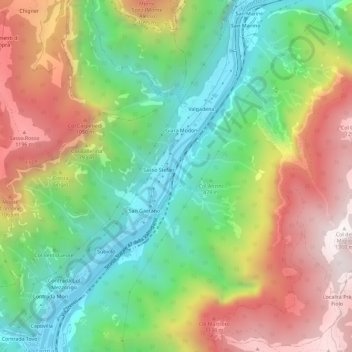
Name: Rivalta topographic map, elevation, terrain.
Location: Rivalta, Valbrenta, Vicenza, Veneto, 36029, Italy (45.85986 11.66081 45.89986 11.70081)
Average elevation: 669 m
Minimum elevation: 146 m
Maximum elevation: 1,366 m
Thank you for supporting this site ❤️
Make a donation
Make a donation
Gear up for your next adventure:
As an Amazon Associate, this site earns from qualifying purchases at no extra cost to you.