
Vidin topographic map
Interactive map
Click on the map to display elevation.
About this map
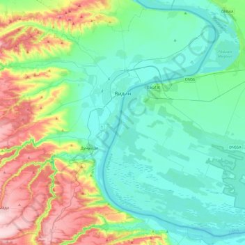
Name: Vidin topographic map, elevation, terrain.
Location: Vidin, Видин, Bulgarije (43.79350 22.59706 44.10009 23.04856)
Average elevation: 89 m
Minimum elevation: 24 m
Maximum elevation: 276 m
Other topographic maps
Click on a map to view its topography, its elevation and its terrain.
Милчина лъка
Милчина лъка, Грамада, Видин, Bulgarije
Average elevation: 198 m