Geolocate

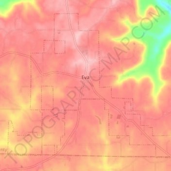
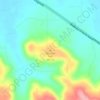
Eva topographic map

Click on the map to display elevation.

Eva

According to the U.S. Census Bureau, the town of Eva has a total area of 4.3 square miles (11 km2), of which 0.03 square miles (0.08 km2), or 0.74%, are water. The town center, at an elevation of 1,105 feet (337 m) above sea level, is just north of the Tennessee Valley Divide. The town drains west toward Flint Creek and east toward Cotaco Creek, both of which are north-flowing tributaries of the Tennessee River. The southernmost parts of town drain south to Eightmile Creek, a tributary of the Broglen River and part of the Mulberry Fork of the Black Warrior River watershed.

Wikipedia (CC-BY-SA 3.0)

About this map

Name: Eva topographic map, elevation, terrain.

Location: Eva, Morgan County, Alabama, United States (34.30656 -86.78903 34.35278 -86.72290)

Average elevation: 313 m

Minimum elevation: 204 m

Maximum elevation: 351 m

Other topographic maps

Click on a map to view its topography, its elevation and its terrain.
Laceys Spring

United States > Alabama > Morgan County

Average elevation: 213 m

Brooksville

United States > Alabama > Morgan County > Priceville

Average elevation: 238 m

Union Hill

United States > Alabama > Morgan County

Average elevation: 305 m

Albany

United States > Alabama > Morgan County > Decatur

Average elevation: 174 m

Lacon

United States > Alabama > Morgan County

Average elevation: 201 m

Danville

United States > Alabama > Morgan County

Average elevation: 185 m

Stanton Hill

United States > Alabama > Morgan County

Average elevation: 223 m

Cedar Lake

United States > Alabama > Morgan County > Decatur

Average elevation: 177 m

Albany

United States > Alabama > Morgan County > Decatur

Average elevation: 174 m

Decatur

United States > Alabama > Morgan County > Decatur > Decatur

Average elevation: 190 m

Gear up for your next adventure:

👟Waterproof Leg Gaiters - Keep mud and water out of your boots in boggy terrain
📱Phone Mounts for Hiking - Secure mounts to carry your phone on trails
Insulated Travel Mugs - Keep drinks hot while surveying the landscape from a summit
🧣Neck Gaiters - Protects against wind and sun on exposed ridges and peaks
🧢Thermal Beanie Hats - Prevent heat loss from the head in windy summit conditions

As an Amazon Associate, this site earns from qualifying purchases at no extra cost to you.