
Уруп topographic map
Interactive map
Click on the map to display elevation.
About this map
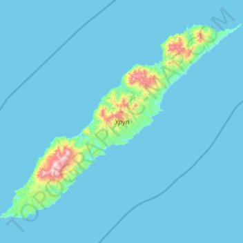
Name: Уруп topographic map, elevation, terrain.
Average elevation: 54 m
Minimum elevation: 0 m
Maximum elevation: 1,397 m
Other topographic maps
Click on a map to view its topography, its elevation and its terrain.
Paramushir
Paramushir, Северо-Курильский городской округ, Óblast de Sajalín, Distrito federal del Lejano Oriente, 694550, Rusia
Average elevation: 94 m