
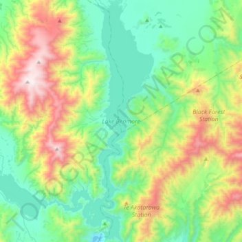
Lake Benmore topographic map
Interactive map
Click on the map to display elevation.
About this map
Name: Lake Benmore topographic map, elevation, terrain.
Average elevation: 746 m
Minimum elevation: 269 m
Maximum elevation: 1,887 m
Other topographic maps
Click on a map to view its topography, its elevation and its terrain.
Mackenzie District
Mackenzie District, Canterbury, Neuseeland
Average elevation: 961 m
Selwyn District
Selwyn District, Canterbury, Neuseeland
Average elevation: 679 m
Aoraki / Mount Cook
Aoraki / Mount Cook, Mackenzie District, Canterbury, Neuseeland
Average elevation: 2,920 m
Godley Glacier
Godley Glacier, Mackenzie District, Canterbury, Neuseeland
Average elevation: 1,579 m
Südinsel
Südinsel, Ashburton District, Canterbury, Neuseeland
Average elevation: 201 m