
Hollenfels topographic map
Interactive map
Click on the map to display elevation.
About this map
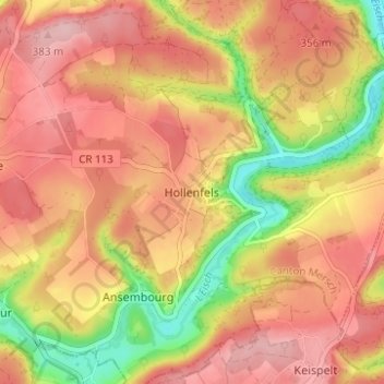
Name: Hollenfels topographic map, elevation, terrain.
Location: Hollenfels, Helperknapp, Canton Mersch, 7435, Luxembourg (49.69282 6.02837 49.73282 6.06837)
Average elevation: 327 m
Minimum elevation: 225 m
Maximum elevation: 390 m