
Cantón Sarchí topographic map
Interactive map
Click on the map to display elevation.
About this map
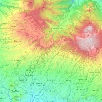
Name: Cantón Sarchí topographic map, elevation, terrain.
Location: Cantón Sarchí, Provincia de Alajuela, Costa Rica (10.04835 -84.36225 10.27687 -84.22655)
Average elevation: 1,514 m
Minimum elevation: 756 m
Maximum elevation: 2,688 m