Geolocate

Karpi topographic map

Click on the map to display elevation.

About this map

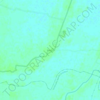
Name: Karpi topographic map, elevation, terrain.

Location: Karpi, Arwal, Bihar, India (25.14150 84.70991 25.18150 84.74991)

Average elevation: 73 m

Minimum elevation: 70 m

Maximum elevation: 78 m

Gear up for your next adventure:

🔦Keychain LED Torches - Emergency backup light for finding gear in your pack
Camping Shelters - Emergency and lightweight shelters for outdoor use
🥤Hiking Water Bottles - Reusable bottles for hydration on the trail
🥄Titanium Camping Sporks - The ultimate lightweight utensil for trail meals
🌄Compact Monoculars - Lightweight optics for hiking

As an Amazon Associate, this site earns from qualifying purchases at no extra cost to you.