
Thank you for supporting this site ❤️
Make a donation
Make a donation
Gear up for your next adventure:
As an Amazon Associate, this site earns from qualifying purchases at no extra cost to you.
Iannello topographic map
Click on the map to display elevation.
Thank you for supporting this site ❤️
Make a donation
Make a donation
Gear up for your next adventure:
As an Amazon Associate, this site earns from qualifying purchases at no extra cost to you.
About this map
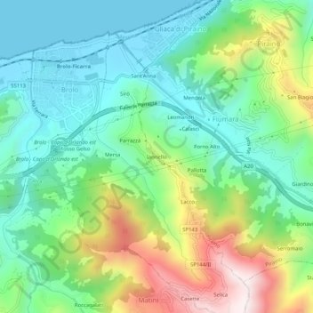
Name: Iannello topographic map, elevation, terrain.
Location: Iannello, Brolo, Messina, Sicilia, 98061, Italia (38.12677 14.82368 38.16677 14.86368)
Average elevation: 215 m
Minimum elevation: 0 m
Maximum elevation: 682 m
Thank you for supporting this site ❤️
Make a donation
Make a donation
Gear up for your next adventure:
As an Amazon Associate, this site earns from qualifying purchases at no extra cost to you.