Geolocate

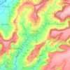
Lightpill topographic map

Click on the map to display elevation.

About this map
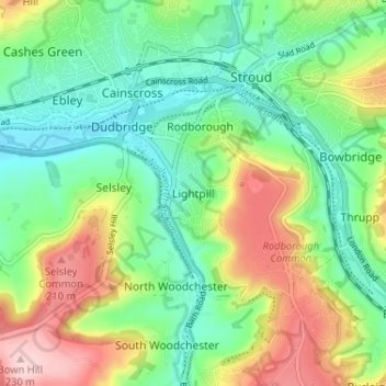
Name: Lightpill topographic map, elevation, terrain.

Location: Lightpill, Stroud, Gloucestershire, England, GL5 3QY, United Kingdom (51.71331 -2.24958 51.75331 -2.20958)

Average elevation: 102 m

Minimum elevation: 29 m

Maximum elevation: 233 m

Gloucestershire trails, hiking, mountain biking, running and outdoor activities

Other topographic maps

Click on a map to view its topography, its elevation and its terrain.
Cranham

United Kingdom > England > Gloucestershire > Stroud

Average elevation: 196 m

Painswick

United Kingdom > England > Gloucestershire > Stroud

Average elevation: 163 m

Berkeley

United Kingdom > England > Gloucestershire > Stroud

Average elevation: 15 m

Stonehouse

United Kingdom > England > Gloucestershire > Stroud

Average elevation: 50 m

Cam

United Kingdom > England > Gloucestershire > Stroud

Average elevation: 69 m

Alderley

United Kingdom > England > Gloucestershire > Stroud

In A Topographical Dictionary of England by Samuel Lewis published in 1831, Alderley is described thus.

Average elevation: 95 m

Frocester

United Kingdom > England > Gloucestershire > Stroud

Average elevation: 57 m

Alkington

United Kingdom > England > Gloucestershire > Stroud

Average elevation: 31 m

Alderley

United Kingdom > England > Gloucestershire > Stroud

In A Topographical Dictionary of England by Samuel Lewis published in 1831, Alderley is described thus.

Average elevation: 95 m
Gear up for your next adventure:

🎒Multi-day Trekking Packs - Large capacity backpacks for wild camping and long-distance trails
🎿Telescopic Trekking Poles - Reduces knee strain on steep topographic descents
🧊Insulated Flasks - Keeps drinks hot or cold during hikes
🧼Technical Clothing Wash - Special soap to clean and restore waterproof membranes
🐕Hiking Dog Harnesses - Rugged harnesses for taking your companion on mountain trails

As an Amazon Associate, this site earns from qualifying purchases at no extra cost to you.