
Mukali topographic map
Interactive map
Click on the map to display elevation.
About this map
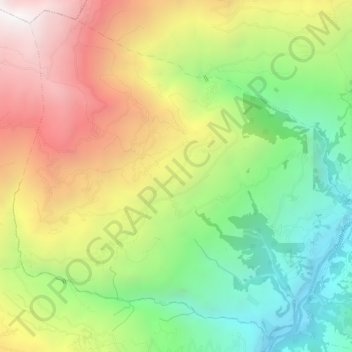
Name: Mukali topographic map, elevation, terrain.
Location: Mukali, Dudhkaushika, Solukhumbu, Province #1, Nepal (27.41643 86.64793 27.46026 86.70016)
Average elevation: 1,606 m
Minimum elevation: 699 m
Maximum elevation: 2,735 m
Other topographic maps
Click on a map to view its topography, its elevation and its terrain.
Phortse Tenga
Nepal > Solukhumbu > Phortse
Phortse Tenga, Phortse, Khumjung, Khumbupasanglahmu, Solukhumbu, Koshi Province, 56002, Nepal
Average elevation: 4,088 m
Chamar
Nepal > Solukhumbu > Namche
Chamar, Namche, Khumbupasanglahmu, Solukhumbu, Koshi Province, Nepal
Average elevation: 6,818 m
Gyachung Kang
Nepal > Solukhumbu > Khumjung
Gyachung Kang, Khumjung, Khumbupasanglahmu, Solukhumbu, Province #1, Nepal
Average elevation: 7,006 m
Khumbu Glacier
Nepal > Solukhumbu > Khumjung
Khumbu Glacier, Khumjung, Khumbupasanglahmu, Solukhumbu, Province #1, Nepal
Average elevation: 6,296 m
Khumjung
Khumjung, Khumbupasanglahmu, Solukhumbu, Province #1, 56002, Nepal
Average elevation: 5,306 m
Cho Oyu
Nepal > Solukhumbu > Khumjung
Cho Oyu, Khumjung, Khumbupasanglahmu, Solukhumbu, Koshi Province, Nepal
Average elevation: 7,339 m
Mera Peak
Nepal > Solukhumbu > Bung
Mera Peak, Bung, Mahakulung, Solukhumbu, Province #1, Nepal
Average elevation: 5,709 m