Geolocate

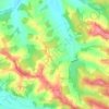
Miradoux topographic map

Click on the map to display elevation.

About this map

Name: Miradoux topographic map, elevation, terrain.

Location: Miradoux, Condom, Gers, Occitania, Metropolitan France, 32340, France (43.95507 0.70360 44.04137 0.80910)

Average elevation: 126 m

Minimum elevation: 75 m

Maximum elevation: 225 m

Other topographic maps

Click on a map to view its topography, its elevation and its terrain.

Le Tourmalet

France > Occitania > Gers > Saint-Pierre-d'Aubézies

Average elevation: 173 m

Tucon

France > Occitania > Gers > Gazax-et-Baccarisse > Gazax

Average elevation: 196 m

Gaugens

France > Occitania > Gers > Ordan-Larroque

Average elevation: 196 m

Lamaison

France > Occitania > Gers > Tournan

Average elevation: 250 m

Tucon

France > Occitania > Gers > Gazax-et-Baccarisse

Average elevation: 196 m

Loc

France > Occitania > Gers > Caupenne-d'Armagnac

Average elevation: 108 m

Balarin

France > Occitania > Gers > Montréal

Average elevation: 128 m

Gear up for your next adventure:

🥄Titanium Camping Sporks - The ultimate lightweight utensil for trail meals
🥤Collapsible Water Bottles - Save space in your rucksack as you consume your water
🧰Survival Kits - Emergency tools for remote environments
🛰️Outdoor GPS Navigation - Navigation devices for remote and off-grid areas
🚲Cycling GPS Computers - Track elevation and topographic routes on two wheels

As an Amazon Associate, this site earns from qualifying purchases at no extra cost to you.