
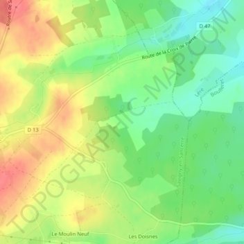
Le Champ Plaide topographic map
Interactive map
Click on the map to display elevation.
About this map
Name: Le Champ Plaide topographic map, elevation, terrain.
Average elevation: 198 m
Minimum elevation: 167 m
Maximum elevation: 233 m
Other topographic maps
Click on a map to view its topography, its elevation and its terrain.
Le Brûlis
France > Centre-Val de Loire > Cher > Savigny-en-Sancerre
Le Brûlis, Savigny-en-Sancerre, Bourges, Cher, Centre-Val de Loire, France métropolitaine, 18240, France
Average elevation: 249 m