
Bahador topographic map
Interactive map
Click on the map to display elevation.
About this map
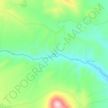
Name: Bahador topographic map, elevation, terrain.
Average elevation: 2,108 m
Minimum elevation: 1,958 m
Maximum elevation: 2,417 m
Other topographic maps
Click on a map to view its topography, its elevation and its terrain.
Sahand
Iran > East Azerbaijan Province > Bostanabad County > دهستان سهندآباد
Sahand is one of the highest mountains in Iranian Azerbaijan, in addition to being an important dormant volcano in the country. The Sahand mountains are directly south of Tabriz, the highest peak of which is Kamal at an elevation of 3,707 m (12,162 ft). Approximately 17 peaks can be accounted for as being over…
Average elevation: 3,118 m
Noshahr
Iran > East Azerbaijan Province > Bostanabad County > دهستان اوجان شرقی
Average elevation: 2,003 m