
Escobal topographic map
Interactive map
Click on the map to display elevation.
About this map
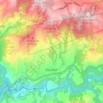
Name: Escobal topographic map, elevation, terrain.
Location: Escobal, Cantón Atenas, Alajuela Province, 20508, Costa Rica (9.92030 -84.45742 9.96927 -84.39426)
Average elevation: 565 m
Minimum elevation: 131 m
Maximum elevation: 1,075 m
Other topographic maps
Click on a map to view its topography, its elevation and its terrain.