
Pierson topographic map
Interactive map
Click on the map to display elevation.
About this map
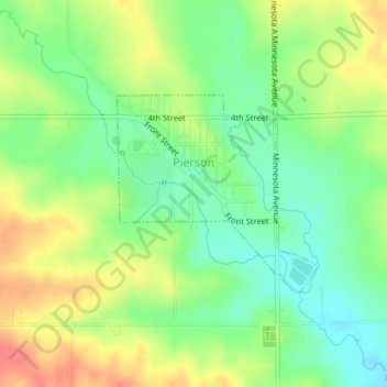
Name: Pierson topographic map, elevation, terrain.
Location: Pierson, Woodbury County, Iowa, États-Unis d'Amérique (42.53503 -95.87477 42.54886 -95.85596)
Average elevation: 399 m
Minimum elevation: 372 m
Maximum elevation: 432 m