
Cesta topographic map
Interactive map
Click on the map to display elevation.
About this map
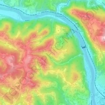
Name: Cesta topographic map, elevation, terrain.
Location: Cesta, Krško, 8270, Slovénie (45.95295 15.44516 45.99295 15.48516)
Average elevation: 295 m
Minimum elevation: 148 m
Maximum elevation: 474 m
Other topographic maps
Click on a map to view its topography, its elevation and its terrain.